Space Planning

Post Covid Building Data as a Foundation

The impact of Covid19 and the Coronavirus to our shared Economy has been significant and will undoubtedly change the landscape of our we interact with real estate, our environment and each other for years to come.  

What we know for certain is that the importance of having accurate digital data about your building(s), that is remotely accessible, is critical to the decisions making process regarding how to bring them back online.  

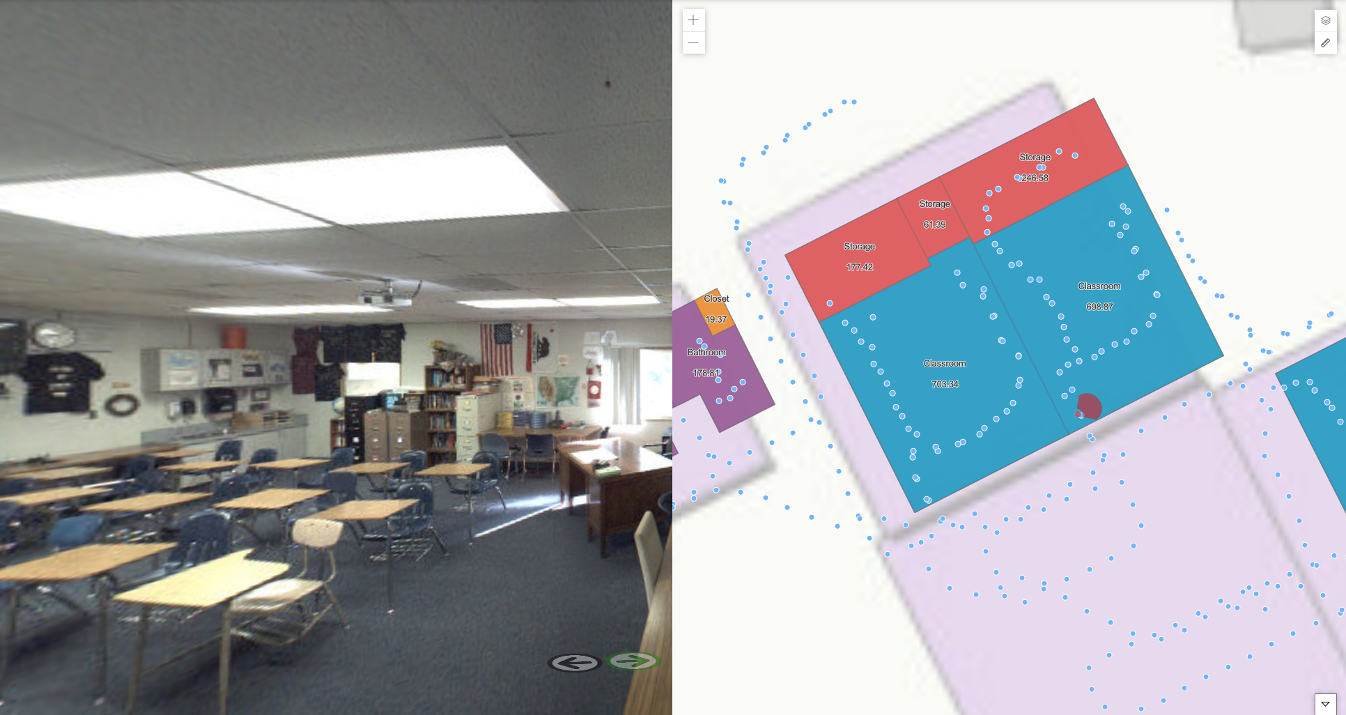
IndoorVu has a unique capability to power many of the systems that will make our global real estate assets safe and secure in this post-Covid19 environment.  Our Image based approach makes it easy to remotely create digital information about all kinds of assets and details inside and around a building.  Whether you are implementing contract tracing solutions, indoor positioning, new space navigation plans or redesigning spaces.  The image data IndoorVu produces, is the critical foundation for those solutions.  

Reach out to learn more about how IndoorVu’s Imagery and data management solutions are helping all kinds of real estate professionals get their buildings back online quickly, safely and efficiently. 

Business Case: Space Planning in Retail

Problem:

A retail bank company wanted to redesign their branches to optimize their layouts for employee experience and customer satisfaction.  They had hundreds of branch locations, but not all of them had good floor plan data.  They needed a scalable solution that could deploy all over the country and produce consistent results.  They also wanted to have flexibility in the level of detail they could extract on a branch by branch basis.  

Summary:

IndoorVu configured resources to collect data across all branch locations that needed data, approximately 50 sites across a dozen states in the US.  The teams spent just over an hour in each branch, hardley impacting the operations of the branch.  The Intelligent Imagery that was collected and produced enabled IndoorVu to quickly create complete 2D geo-referenced floor plans for all the buildings, plus 360 imagery to provide context and additional visual detail.  

IV Portal: Floor Plans, 360 Imagery

IV Portal: Floor Plans, 360 Imagery

Result:

The Bank’s space planning team was able to create a standardized process for assessing and redesigning their spaces.  The IndoorVu Portal was a single web-accessed application that the Bank’s teams could remotely access.  They were able to make rapid, educated decisions about the spaces and the level of effort to achieve the new designs. The Bank also now has a foundation for detailed 3 Dimensional mapping and modeling for future improvements and changes to the branches as they need. 

Business Case: Space Planning and Design in Education

Problem:

This school district was faced with the challenge of redesign their spaces to comply with new Covid-19 restrictions for student spaces.  Their challenge was that they had paper drawings for all their buildings.  They needed to update the drawings, ensure they were correct and scaled, integrate them into GIS tools to optimize the space layouts and enable virtual teams to collaborate on redesigning the spaces.   = 

Summary:

IndoorVu was rapidly collected data at 5 High Schools throughout the district.  From the IndoorVu Intelligent Imagery, geospatial floor plans were generated and enhanced with 360 degree imagery.  The data was loaded into the IndoorVu Portal, provided as CAD (dwg) files and as GIS (geodatabase) files.  

IndoorVu Portal.  2D Floor Plans, 360 Imagery

IndoorVu Portal. 2D Floor Plans, 360 Imagery

Result:

The School District was able to quickly stand up data and a standard workflow across all their High Schools to remotely reconfigure the spaces.  They were able to seamlessly integrate their data into their existing GIS and CAD software tools.  The 360 Imagery provided critical visual information about their spaces so that teams working from home could be effective.  

Business Case: Advanced Building Documentation in Retail

Problem:

Large Retailer acquired 34 new brick and mortar locations.  The new locations were spread all across the east coast of the US and they had little to no documentation about the condition, layout, etc. of the buildings.  They needed to understand what they had bought, how to redesign the spaces and the level of effort that was going to be required to do so.   

Summary:

IndoorVu deployed to the sites of the newly acquired buildings and within 14 days had collected Intelligent Imagery for all the stores, in a total of over 2.4 million square feet across 5 different states.  Within 2 months from the data collection effort, IndoorVu created complete 3D models of all the buildings which included site plans, full ceiling plans, walk path details and 360-degree imagery of every space in every building.  The data was all organized by building, floor and room and delivered via IV Cloud and IV Portal.

Screen Shot 2020-06-10 at 3.51.02 PM.png
IV Portal.  2D Floor Plan, Ceiling Plans, 360 Imagery

IV Portal. 2D Floor Plan, Ceiling Plans, 360 Imagery

Result:

The retailer was able to share this new building data with all stakeholders in their redesign and construction process via a simple web application.  Beyond just having floor and ceiling plans, the 360 Imagery enabled designers, store planners, and store managers to better understand and collaborate throughout the entire process of updating these newly acquired sites.  IndoorVu saved the retailer time, money and significant iterations on design and development.