Problem:
County Government has 55 buildings spread across their region. They want to update their building data, standup an indoor GIS and turn on an indoor routing solution for employees and visitors. They have little to no building models or plans that are digital or accurate.
Summary:
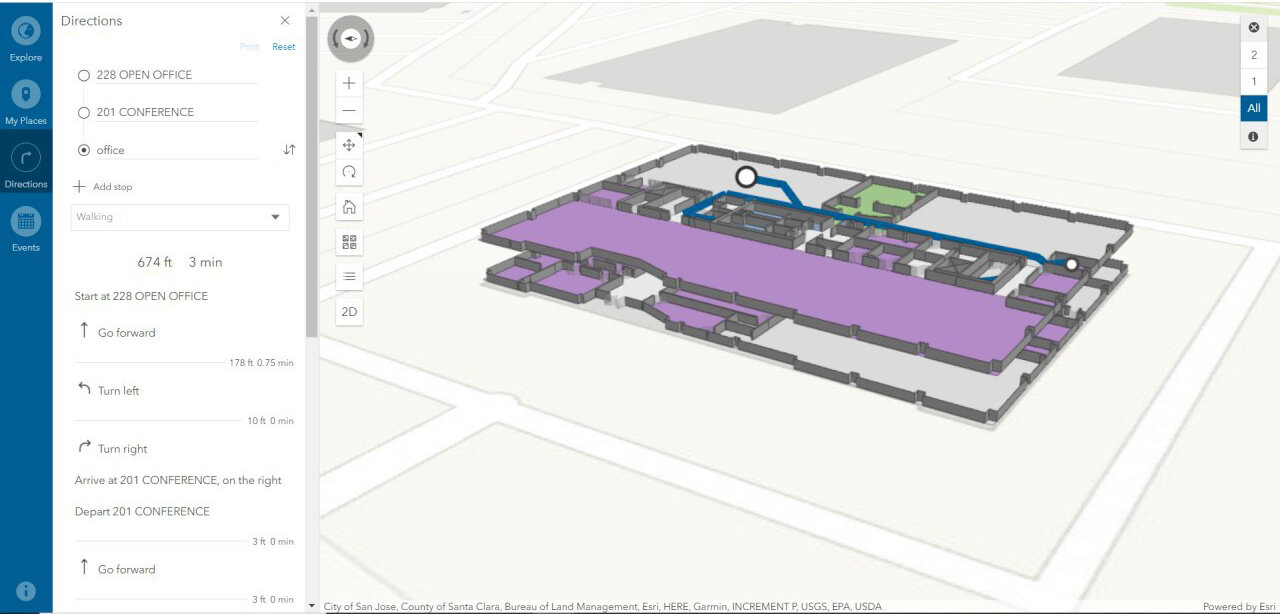
IndoorVu deployed a team to the county and collected Intelligent Imagery for all the country buildings within 14 days. Then rapidly created geo-referenced floor plans and 360 degree imagery. That data was delivered via IndoorVu Portal and integrated directly into the County’s existing Esri ArcGIS infrastructure. IndoorVu also configured the floor plans to import into the Esri ArcGIS Indoors system. That configuration included modifying the floor plan data model as well as developing a network graph to drive user routing and wayfinding.
Result:
The County went from having very little digital data to having a completed digital geospatial system for all their building and assets in a matter of weeks. They have integrated the floor plans and imagery into their existing GIS database, security, facilities management and maintenance systems. They saved administrative time and expense by having a single vendor, IndoorVu, create and produce all the data they needed. They also benefited from having the data seamlessly integrate with their existing systems. The County now has a foundation for future asset details and digital modeling for all of their properties. This reduces the amount of travel their staff must to do maintain the assets, as well as allows them to make data available to 3rd party organizations that can benefit from it.